“All of this is a mere preview”
The El Niño monster is out of control with temperature anomalies 5.4°F above previous records
As of Sept 23, the world’s oceans have recorded 100 consecutive days of unprecedented heat.
As Autumn begins in the Northern Hemisphere, the El Niño leviathan getting warmed up in the Pacific has already broken every temperature record for previous El Niño events. This cyclical weather phenomenon has far exceeded the highest temperature ever recorded in the Pacific Ocean, several months before it was expected to peak. As of Sept. 10, the world’s oceans recorded 100 consecutive days of unprecedented heat. Although El Niño is not technically a cause of climate change, no credible climate scientist questions whether the collossal strength of this year’s anomaly is driven by global heating.
NOAA Mid-September data indicates a 5.4° F (3.05C) increase, breaking the previous high set in 2015.
The most recent forecasts predict a peak of 7.2° F for year’s end, a level that is almost incomprehensible in the context of historical data. It’s a factor of 3X greater than the scientific threshold of a “super El Niño.”
When added to the accelerating pace of global warming and the historically elevated temperatures of the ocean, the prospects of 2027 clocking in as the hottest year of all time are a lock in. And with the climate emergency already supercharging violent weather events this year, the impacts on the planet are already apparent.
Only the beginning
Consensus is that we are actually at the beginning of the most devastating phase of this event. Although the Pacific has already warmed extraordinarily rapidly, NOAA expects El Niño to strengthen further through the autumn and winter. The agency projects a 90% probability of a very strong event during the Northern Hemisphere fall/winter.
That means the classic El Niño consequences should be expected and prepared for beginning now:
- heavy rain and flooding along parts of the Americas,
- drought across Australia and Southeast Asia,
- altered monsoons,
- extreme heat,
- Pacific tropical cyclones,
- challenges to fisheries,
- disruptions to agriculture
Current impact
In late September 2026, the emerging super El Niño is already producing measurable extreme-weather and ecological effects. El Niño is now strong enough to influence weather patterns, but not every extreme event occurring in 2026 can be attributed to it.
Summer 2026 events
Severe drought and water shortages in Southeast Asia
Indonesia and other parts of Southeast Asia are experiencing declining rainfall and water levels. Indonesia has also experienced significant wildfires. The Mekong system is seeing unusually low water levels, affecting agriculture, fisheries and communities dependent on the river.
Wildfires
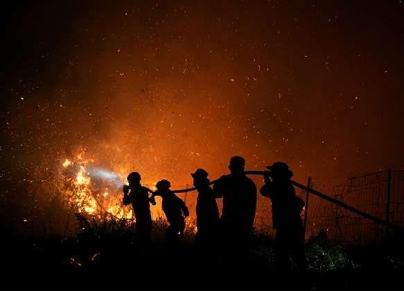
The combination of heat and reduced rainfall has increased fire danger, particularly in Indonesia/Sumatra. There are also substantial drought/fire effects in the Caribbean, where Puerto Rico and neighboring areas experienced unusually dry conditions, low stream flows, grass fires and water-supply problems.
Major impacts on Peru’s fisheries
One of the clearest early effects is occurring off Peru, where unusually warm Pacific waters have disrupted the marine ecosystem. Anchovies have moved into deeper, cooler water, and Peru ended its anchovy fishing season early in August. This is economically significant because anchovies are a major source of fishmeal and fertilizer.
Exceptional heat
The developing El Niño is adding heat to an already warming climate. The contiguous United States experienced its warmest June–August on record in 2026, with widespread drought and extreme heat.
This distinction is important: global warming provides the elevated baseline temperature, while El Niño is now superimposing another source of warming and shifting atmospheric circulation.
5. More powerful and numerous Pacific Cyclones
At the same time, the Pacific is experiencing much more favorable conditions for tropical cyclones. Hurricane Polo reached Category 5 strength off Mexico on September 22, illustrating the contrasting Pacific/Atlantic pattern associated with El Niño.
Flooding and extreme rainfall in parts of the Americas
El Niño shifts the position of the Pacific jet stream and tropical convection, producing drier conditions in some regions and much wetter conditions in others. PAHO reports that drought, flooding, wildfires and food insecurity are already occurring in several countries in the Americas.
The super El Niño has already shown up in Southeast Asian drought and fires, Caribbean water shortages and fires, disrupted Peruvian fisheries, Pacific tropical-cyclone activity, and an unusually suppressed Atlantic hurricane season. But the event is still intensifying, so the largest global effects are likely to develop during the coming fall and winter of 2026–2.
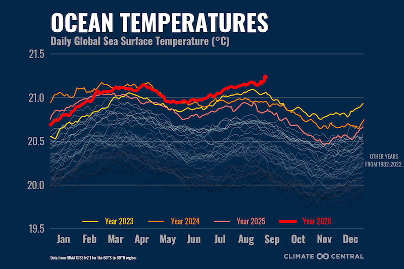
Global warming provides the current elevated baseline temperature, while El Niño is now superimposing another source of warming and shifting atmospheric circulation.